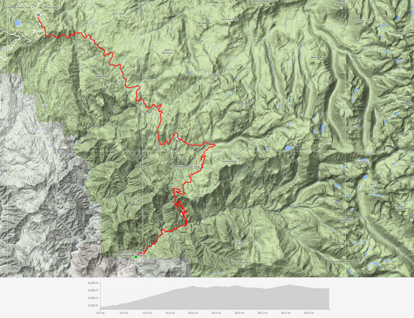
For the past three years, my annual birthday challenge has involved riding my bike across a national park. With Haleakalā and Yosemite under my belt, this year I went in search of tall trees and deep canyons at Sequoia & Kings Canyon National Parks. Sequoia is home to the largest living tree in the world by volume, General Sherman, while Kings Canyon not only shelters the largest remaining grove of giant sequoia trees, but also features one of America’s deepest canyons.
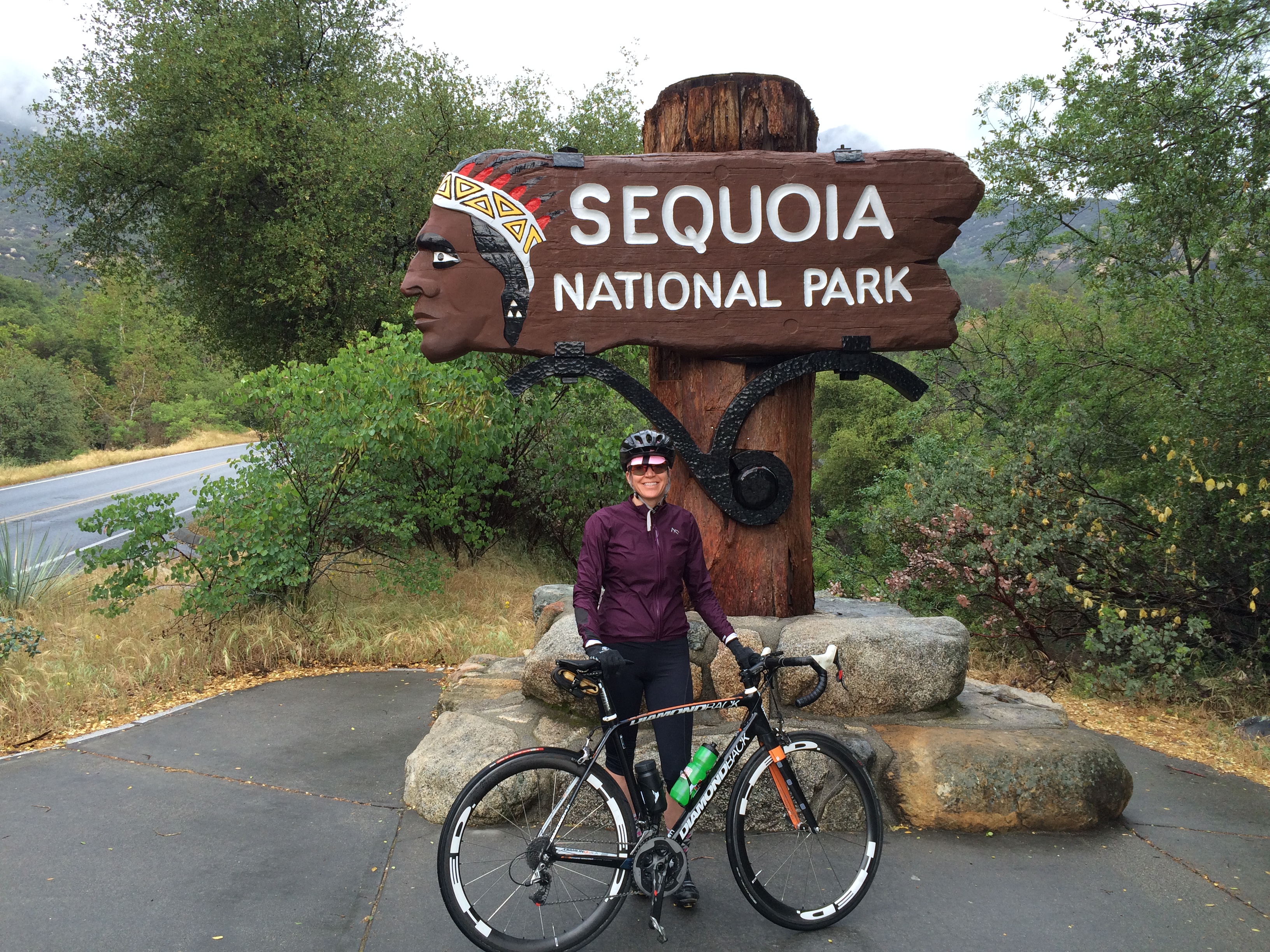
The ride begins at the south or Ash Mountain Entrance of Sequoia National Park, a few miles up from Three Rivers, CA. Beyond the entrance gate, the road climbs steadily for almost 20 miles along the Generals Highway, rising above the Middle Fork of the Kaweah River and through the tree covered foothills surrounding the dome-shaped granite monolith Moro Rock–a sort of mini Half Dome if you will. This HC climb hits double digit grade at times, while veering around a countless number of pristinely paved switchbacks. For those that like to climb, it can only be described as fun.
I had expected a sunny day in the 60s but was instead met with temperature in the 30s and 40s, rain, dense fog, sleet, and at times, hail. The weather definitely made for an interesting (and cold!) ride. Nothing like spending hours in a wet chamois.
After 17 miles of strong effort, you enter the Giant Forest, the magical sequoia groves that tower over you like an ant on a sidewalk. At times, the road passes right between the trees, giving you a real sense of perspective.
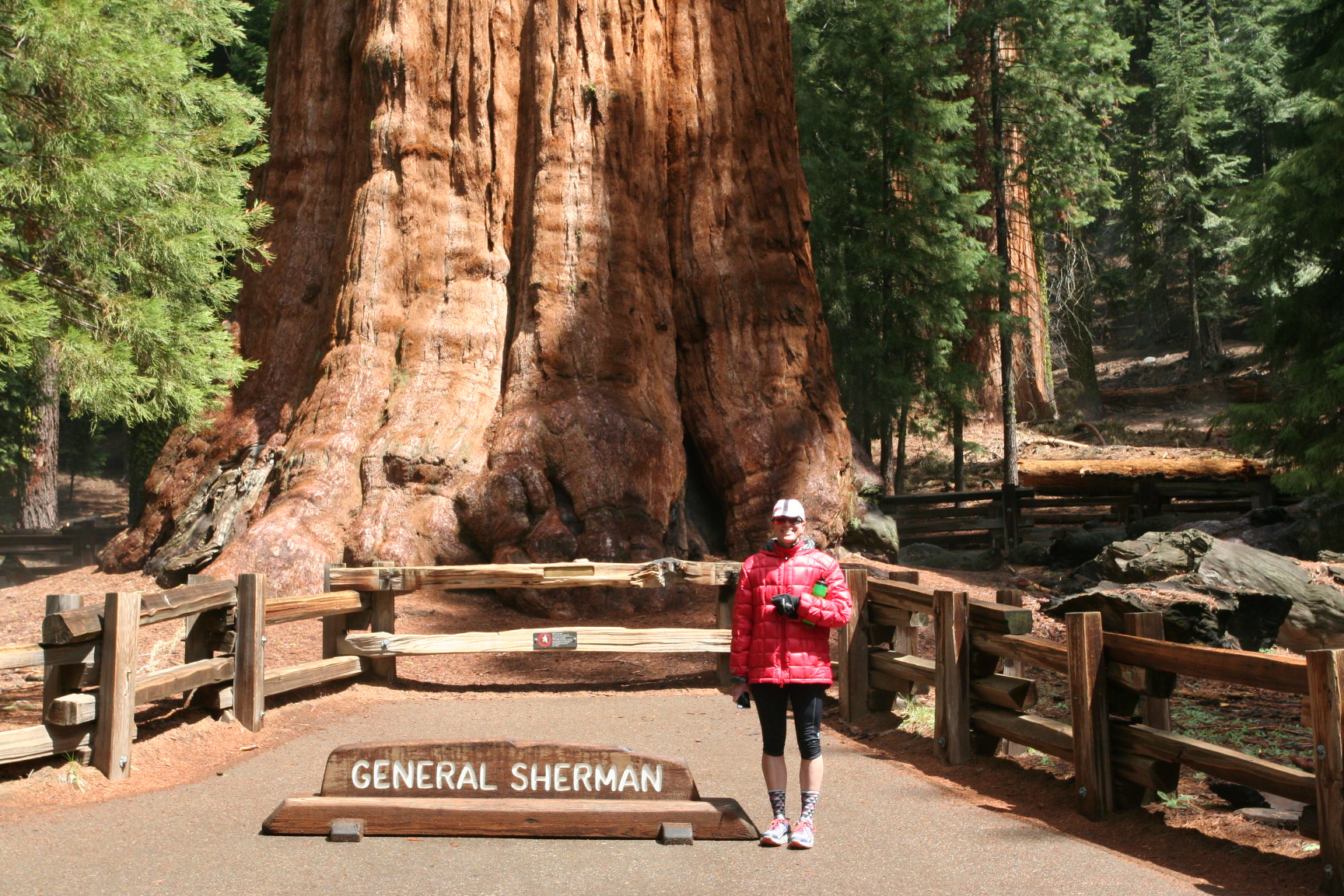
General Sherman awaits your visit at around mile 19–standing 275 feet tall with a ground circumference of nearly 103 feet, Sherman is estimated to weigh over 1,385 tons and has been standing there for 2,200 years. Be sure to pull over here as the magnificent tree is just a short hike from the road and is awe inspiring to stand beneath.
Although you have reached somewhat of a high elevation plateau at General Sherman, the climb is far from over. For the next 30 miles, you oscillate between 6,500 feet and 7,600 feet, riding in and out of giant sequoia groves, with longer climbs up to Little Baldy Saddle (7,370 feet) and the Big Baldy Trailhead (7,600 feet). The closer and further into Kings Canyon you get, the more “Yosemite-esque” the scenery becomes, with peaceful green meadows resting beneath towering granite peaks. With its deep valleys, pockets of skyscraping trees, and distinctive rock outcroppings, Kings Canyon National Park is the place that John Muir once called “a rival to Yosemite.”
My ride ended at Grant Grove along the Kings Canyon Scenic Byway. The grove sits on the border of Sequoia National Forest and is home to General Grant, also known as The Nation’s Christmas Tree. By that afternoon, I had completed 50 miles and climbed over 10,000 feet. My original plan was to cash in my climb reward by cruising the 20+ mile descent down into the bottom of Kings Canyon and the end of Highway 180 at Cedar Grove, some 3,000 feet below. This section of road had just opened at noon that day, having been closed all winter. Given the dense fog and icy road conditions, however, I wasn’t willing to risk crashing on the long descent knowing I wouldn’t be able to enjoy an ounce of scenery along the way.
The actual amount of road access to Kings Canyon is pretty small–a mere 12 miles or so. Over 96% of the two parks is designated wilderness, reachable only by trail and adding a layer of protection to its rich diversity of natural habitats covering elevations ranging from 1,500 feet to 14,500 feet. This is one national park I definitely need to go back and further explore on foot.
Ride Variations: There are many options for extending or even shortening the ride depending on time of year, your willingness to carry gear, or just personal preference. As I was lucky enough to have Terry running SAG duty for the day, I was able to complete a one way ride in April.
If you want to make it a two day outing, you could ride the full 80 miles to Cedar Grove, camp overnight, then ride back out the next day. Campgrounds and lodges dot the entire route offering the possibility to break up the trip into as many sections as you want. Shuttle buses run during the summer months if there is a section of the route you prefer not to ride, but I would check first if the buses take bikes and the schedules.
Road Closures: Depending on the time of year, be sure to check the road closure information. The long road between the parks is not always open and the road to Cedar Grove shuts during winter, usually opening again in May. Traffic was pretty light in April and as speeds through the park are slow, most everyone was courteous in passing.
Supplies: You will find water fountains at all of the major tourist stops such as General Sherman and Grant Grove. There is a restaurant and market at Grant Grove Village, neither of which was open yet in April. Cedar Grove also features a village open in late spring/summer with a restaurant and market.


Stellar ride and Happy Birthday!
Thanks Nick!